Thumbnail Geologic History of Sauvie Island (and environs)
Jim O’Connor, U.S. Geological Survey, oconnor@usgs.gov, 503 251 3222; Nov 2012
200 m.y. — North America splits from Europe and Africa, begins long trek westward overriding Pacific Plate
40 m.y. — Birth of the Cascade Range volcanic arc as subduction zone jumps westward, beginnings of the Coast Range
16 m.y. — First evidence of Columbia River in Portland area, Portland Basin begins to subside
16-12 m.y. — Voluminous Columbia River Basalts flow westward from eastern Oregon, eastern Washington, and western Idaho. More than 175,000 cubic kilometers of basalt bury the landscape; dozens of flows pass through ancestral Columbia River valleys to the Pacific. These flows now form cliffs of Columbia River Gorge, underlie much of the Portland area, and form Warrior Rock
16 m.y. — Continued folding of Portland Hills deflects Columbia River northward, while eastward subsidence deepens Portland basin
8- 2 m.y. — An energized Columbia River deposits broad sheet of river gravel, forming benches flanking Columbia River
4-2 m.y. — Beginning of glacial ages, capture of the Snake River, cutting of Hells Canyon
3-1 m.y. — Modern Cascade Range warps up; volcanoes (Hood, Adams, Saint Helens) grow; Columbia River cuts present gorge
2.6-0.1 m.y. — Numerous small volcanoes of the Boring Volcanic Field pepper the Portland Basin, including Mount Tabor, Rocky Butte, and Prune Hill
1-0.1 m.y. — At least two extensive glaciations encroach Columbia River from southern Washington Cascade Range; episodes of Columbia River deposition of sand and gravel in Portland Basin. Deposition of Oak Island
30-15,000 yr ago — Last glacial age; sea level drops 120 m globally, lowering Columbia River ~100 m in Portland basin. Portland basin coated with windblown silt from ice-age mega-east winds
20-15,000 yr ago — Dozens of great floods from Glacial Lake Missoula repeatedly sweep down Columbia River with volumes as great as 2500 km3, and with discharges as great as 10 million m3/s. Velocities at eastern end of Portland basin attain ~35 m/s but slows downstream as flow ponds behind constricted valley near Kalama. Maximum flood elevation 120 m above present sea level. Sculpts landscape; deposits immense gravel bars along main channels; layered sand, silt, and clay on high hillslopes and in slackwater areas
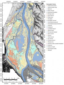
12-5,000 yr ago — Sea level rises rapidly to near present level by about 2000 yrs ago; Columbia and Willamette Rivers fill valley with sand and silt, building of Sauvie Island around older core of Oak Island and Warrior Rock
2,500 yr ago — Pine Creek eruptive episode at Mount St. Helens fills Lewis River valley and builds out Woodland bottoms.
2,500-60 yr ago — Channel migration and overbank deposition, mainly during Columbia River freshets, builds modern Sauvie Island.
2,500(?) yr ago — Strong east winds blow Columbia River sand and silt into large dunes along southwest Sauvie Island margin and Portland Hills, providing island high ground for Native Americans and early homesteaders
2,500(?) yr ago — Continued sea level rise perhaps diverts mainstem Willamette River east, cleaving Sauvie Island from north Portland
1420-1460 AD Bonneville Landslide at “Bridge of the Gods” temporarily blocks Columbia River 75 m high. Resulting catastrophic flood inundates Sauvie Island with sand and silt, changes distribution of Native American settlements
1480-1482 AD Kalama eruption at Mount St. Helens dusts island with ash, fills Lewis River valley with sand and mud
Jan. 26, 1700 — Giant Cascadia earthquake shakes entire Pacific Northwest, sends tsunami across Pacific, shakes, liquefies and perhaps slumps north end of Sauvie Island
1792 AD — Point Warrior named by Lieutenant William R. Broughton of the Vancouver expedition
Dec. 1861 — Regional rain-on-snow flooding in the Pacific Northwest, exceptionally large Willamette River flood
June 7, 1894 — Largest historic flood on the Columbia River, 34,000 m3/s from snowmelt, island inundated to 33 ft asl
June 1, 1948 — Vanport flood on the Columbia River, 28,600 m3/s, newly built Sauvie Island dikes hold water back (barely)
May 18, 1980 — Mount St. Helens erupts, dramatically changes island views.

